
After our spring break trip to the southwest in April 2011, we all picked our three favorite hikes from vacation. Here are our picks.
My husband and daughter chose the hike down Bright Angel Trail at the Grand Canyon as one of their favorites. You can see the trail at left in this photo as it leads to the edge of Plateau Point. Someday we will hike all the way down there, but with young kids, this trip was not the one. Instead we hiked for about a half hour down.

We met riders on mules (which look awfully big to me, more like horses?) on our way down. You can still see Plateau Point at the photo's center left.

Both kids and adults chose the hike/scramble up Bell Rock in Sedona as one of their favorites. There is a trail marked by rock cairns in chicken wire that suggest the best route, but it's easy to lose your way. The safest way down if you can't find a marker is to look for the cracks with the rock falls. In the pic below, you may get up that way, but good luck following that same path down.

This hike also had the most beautiful views of our entire trip.

Another of my son's favorite hikes was Blue Mesa in Petrified Forest National Park. I only made it the first 100 yards or so on this one, because I was recovering from food poisoning. It's about a mile round trip and coming up the last part is quite steep.

I spy with my little eye...

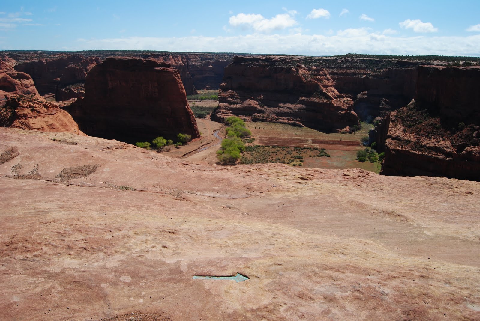
One of my favorite hikes was the one to White House Ruins in Canyon de Chelly National Monument. The White House Ruins are in and at the bottom of the wall.


Note the green arrow carved into the rock floor. This hike down involved a tunnel and caves.
A farmer was burning something at the base of one of the cliffs (smoke on right). This switchback trail had sharp drop-offs that is not well-illustrated by these photos.

Another favorite hike was at Great Sand Dunes National Park. Although there is not a definite trail that leads to the top because of the shifting sand, there is a post to let you know when you've gotten to the top. I can't say I've seen it in person. You may hike all over the sand dunes and make your own trails. Most people hike up the ridges and slide, jump, or roll down the steep edges.


Normally there's a stream at the base of the Great Sand Dunes that comes from the melting ice on the nearby mountains. Medano Creek, as it is named, was so dry that it had crept far back into the mountains and we didn't see it or have to cross it this time to get to the dunes. This was a great bonus in that the water is usually frigid, and on a day when the air temperature was in the 40s, we were happy to avoid the wet feet. The sand, however, was still plenty hot under our feet.
Our final favorite hike was just outside Great Sand Dunes National Park, where you'll find a small sign for Zapata Falls. You turn onto a rocky road maintained by the BLM and drive for a few miles up the side of a mountain. The parking is by a lookout area and then the trail is a rocky path that leads higher up on the mountainside. We were fortunate to be there when the creek that flows from Zapata Falls was still frozen, which allowed us to hike on it to get back into the gorge and see the actual waterfall. The waterfall is hidden within the rocky canyon. It was still partly frozen but you could hear and see the water falling behind the sheet of ice.

The way to the waterfall is through the dark, narrow passage at back left.


Photo looking up:


I hope you get to experience one of these hikes soon!
No comments:
Post a Comment